Join master hiker, AJ, on a 5-hours long hike that will start on the North Stanton Street Trailhead (MAP) and will continue along the 1000 steps trail. You will veer off the trail and follow an Arroyo trail up to the actual crash site and view the remaining wreckage. Then on to the Memorial and back down the arroyo to 1000 steps trail.
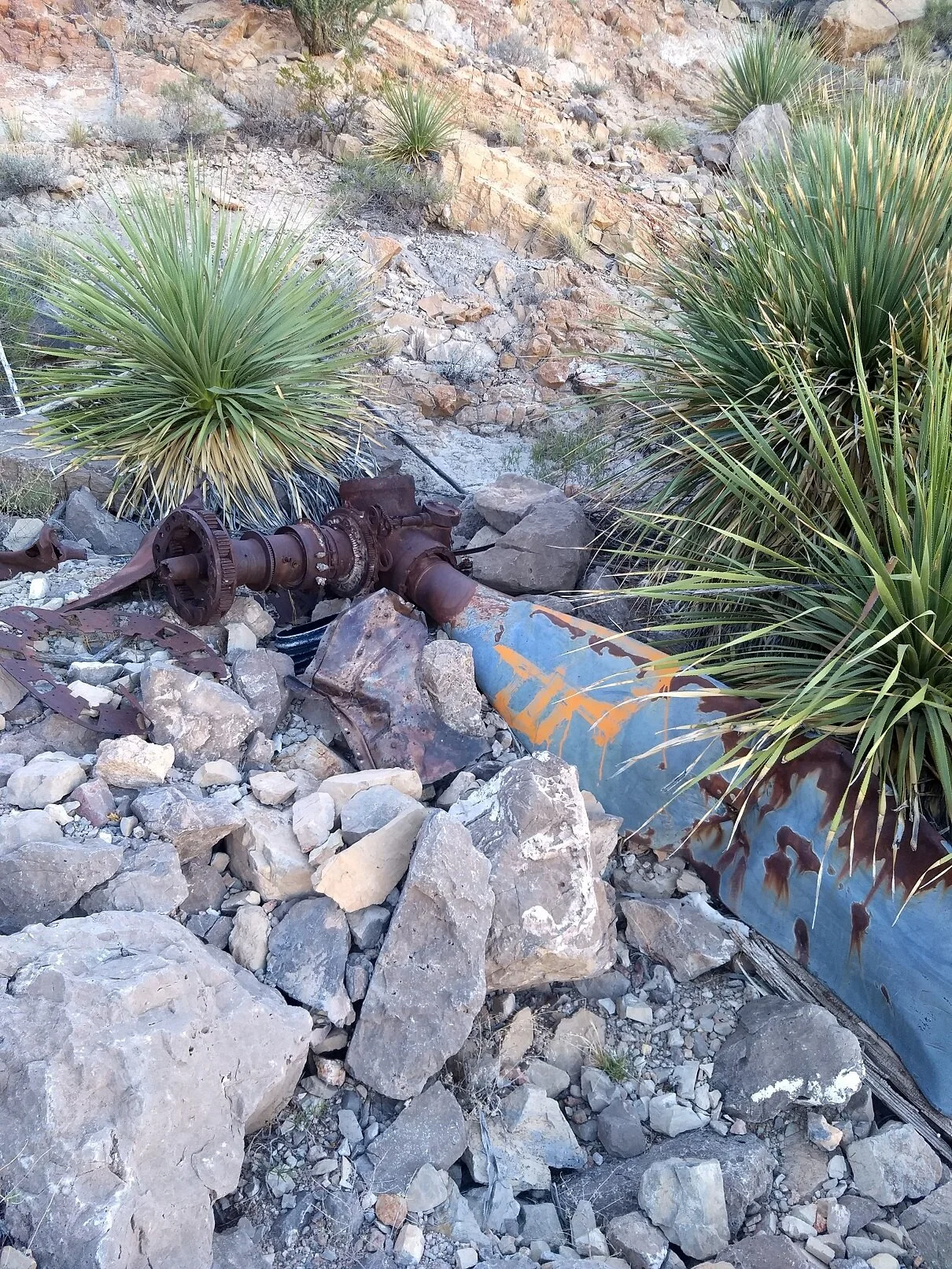
This will be a moderate to difficult hike, due to the off-trail section, the possible wind/weather this time of year and the length of the hike. There is some significant wreckage left to view, and the memorial is on a rock spire above the arroyo floor. Please dress appropriately for the expected weather (see link below) and bring plenty of water (minimum 3 Liters).
Check Forecast here: https://forecast.weather.gov/MapClick.php?lat=31.759160000000065&lon=-106.48748999999998#.WqsdZ-jwZPY
You will need: 3 liters of water (minimum), strong hiking shoes/boots (loose rocks and thorny plants), gloves and long pants are recommended, leather gardening gloves or similar for protection from rocks and plants. Wear sunscreen and a good hat for protection from the wind and weather. Bring snacks and any medications that you may need. Bring a mask. Hike is not pet-friendly due to the terrain.
For more information, contact angusjohnston711@gmail.com
From a slide presentation, “Airplane Crashes in the Franklin Mountains” by Dr. Cesar Mendez and Terry Sunday


